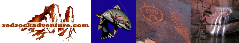
Fishing for Grayling at Round and Sand Lakes
Read more of our Uinta Mountain articles
By Dave Webb
The high Uintas are calling. The highest mountain passes open up during mid or late July, making it possible to hike to your heart's content. Conditions should remain ideal through September; then storms will start to shut things down and make backpacking dangerous.
I rushed the season a bit and took a group into Round and Sand lakes on June 15, and we had a great time. Both lakes are full of hungry arctic grayling, and we caught a bunch of them on small wet flies.
We would throw out a fly and then bring it in slowly, so it stayed just under the water's surface. Virtually every cast produced a strike – sometimes two or three if we didn't hook the fish. Grayling have soft mouths; they are tricky to hook and easy to lose. They are feisty, and often throw the hook as they thrash around. We lost two or three for every fish we landed.
Fun fishing.
Several lakes in the Uintas have populations of grayling, and most produce fast fishing. But the unique fish don't get very large – 6-8 inchers are common and a 12 incher is big.
Round and Sand have some of the bigger grayling in the Uintas. We caught a couple 11 inchers.
The lakes are in the Weber drainage, along the Dry Fork Trail. The trailhead is above Oakley, just a hour and a half or so from Salt Lake. The trail is well marked to Round, which is about three and one half miles in, but becomes faint in spots beyond that. The trail is pretty steep and rocky. People take horses up it, but they need to be well trained and well shod to move over the rocks. (Many trees fell across the trail over the winter, and had not yet been removed when we visited the area. The trail should be cleared by early July.)
Our trip was just a day-hike – the lakes are close enough that you can enjoy the hike and the fishing and still sleep in your own bed. But it makes for a long and tiring day. It's an ideal area for an overnighter.
Round is a small lake, only five acres, in a marshy meadow at 9,940 feet elevation. It has open shorelines, making fly fishing easy, and it is surrounded by thick timber. It's a beautiful area.
Except for the bugs. We were literally eaten alive by mosquitoes. There were patches of snow around the lake when we where there, and we thought it was too early for mosquitoes and so we didn't bring repellent. Bad mistake. The bugs swarmed around us and dozens bit at the same time. You could literally kill eight with one swat. But no matter how many you swatted, hundreds more were waiting for a chance at you.
Now and then the breeze would pick up and blow them away. But not nearly often enough.
There are several good campsites at Round, and some good springs. The campsites are used heavily, and the lake gets a moderate amount of fishing pressure. Enough people visit the area that litter can be a problem if campers are not careful. Pack out your garbage.
Sand Lake is a half-mile farther up the trail. It's bigger – covering 19.3 acres – and 51 feet deep. It's elevation is 10,140 feet.
At Sand steep rocky slopes with big trees come right down to the water, making it picturesque but difficult to fly fish. It's a wonderful lake for a float tube or rubber raft.
The fishing seemed to be a little slower at Sand, but the average fish was a little bigger.
Besides the grayling, there are a few brookies and cutts in both lakes.
There were few mosquitoes at Sand! Perhaps it was because there was no boggy shoreline, or perhaps because there was more snow in the area.
(Bugs are a big problem throughout the high country. Bring repellent no matter where and when you hike.)
The Dry Fork Trail was wet and muddy when we were there. You have to wade the stream several times, and springs create muddy areas here and there.
There is plenty of spring water throughout the area but you need to be very careful if you plan to drink it. Giardia is a big problem. I never drink from a spring unless I get right to the spot where it comes from hard ground. Many times springs flow for a few feet, go underground, then emerge a few feet away. The water may come from a boggy mess just up the hill, if you aren't careful.
Carry water with you, and replenish your supply when you come to a source you are sure is pure. It's much better to be safe than sorry. (A good water filter is handy to have along. Be sure to use it properly.)
Dehydration, heat exhaustion and hypothermia are big problems in the high country. The atmosphere is thin and so the sun's rays are more intense. They can burn your skin and dry you out quickly. Temperature variations often get to people. If a cloud blows in front of the sun the air temperature may quickly drop from hot to cool. You can also get cold fast if you get wet, or if a storm comes up. It can snow any day of the year in the high country, and the sky can go from completely clear to black and menacing within just a few minutes. Nights are always cold.
When people get in trouble it's usually because they aren't prepared for the extremes. Take warm clothing and emergency supplies, even if you only plan a day hike and the sky is clear as a bell.
Always take rain gear if you are camping – it often rains or snows once or twice a day. Dress in layers so you can adjust to changing conditions. Hiking sandals are popular now, and they are ok for most situations, but you should take some good shoes and warm socks too.
You need a tent if you plan to camp in the Uintas. It's cold at night, it will probably rain, and you need someplace to get away from the bugs.
You can drive to many lakes on the edge of the Uintas where you can camp and fish and have a wonderful time. But to do the Uintas right you need to backpack. It's an incredible experience.
Some of the high country lakes are becoming very popular – you may find a crowd at the end of a steep hike. But there are hundreds of lakes in these mountains and it is easy to get away from the crowds into one of the last true wilderness areas in the continental U.S.
The DWR publishes a series of booklets which describe the lakes and streams of the Uintas. The booklets include maps and directions which are invaluable as you plan a trip. By studying them you can identify lakes which are seldom visited and which offer fast action for big fish.
Copyright Dave Webb, 2005